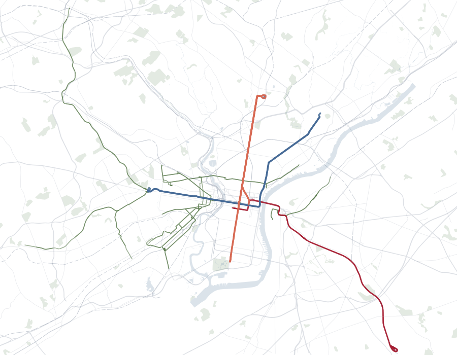
The Modeled Network
Streets, transit, connections, and travel times as represented.
- Least-cost modeled route
- High modeled accessibility
Research Idea
Two places can be the same distance from a destination and just as well served. People still use one and avoid the other.
People leave parts of the city out of the routes they will actually consider. Those exclusions are not random. They follow patterns across people and places, and they can pull experienced accessibility a long way from what a model predicts. I want to know when that happens, and whether planners should do anything about it.
Mental maps of neighborhoods and places.
Perception influences daily routing decisions.
Access as perceived, navigated, and realized.
The Core Idea
A map may show one best route, but that does not mean every traveler will treat it as available. A longtime resident may know the area well; a visitor may avoid it; someone traveling late at night may rule it out entirely.
Streets, transit, connections, and travel times as represented.
The narrower set of routes a traveler will actually consider.
These differences are not just personal quirks. Some come from the street itself; others come from what people have heard, learned, or experienced there. In practice, the two can be difficult to separate.
The same street may belong to different practical choice sets at 2 p.m. and 11 p.m.
Why This Matters
Accessibility measures usually begin with what appears on the map: streets, transit, travel times, and nearby destinations. But a connection that people routinely rule out may deliver less access than the model assumes.
A new street, crossing, or station creates less access than expected if the people it is meant to serve routinely avoid it. Infrastructure can be built without becoming behaviorally available.
Two people can face the same street and transit network but have different opportunities within practical reach. Familiarity, past experience, safety, and physical ability can all change the network each person is willing to use.
An avoided route could point to a dangerous crossing, outdated information, unfamiliarity, or a blind spot in the model. Those are different problems and do not call for the same response.
The Conceptual Backbone
The modeled network defines what is technically reachable. The behaviorally available network defines what people are actually willing to consider. The difference shapes experienced accessibility.
What narrows the second network is not idiosyncratic taste alone. Individual perception belongs here because it is systematically related to group position, prior experience, information, place, time, and mobility constraints.
A personal preference becomes more relevant to planning when the same pattern appears repeatedly across particular people or places.
A Conceptual Framework
Streets, transit, connections, and travel times as represented, and the modeled accessibility calculated from them.
The routes and places a person keeps in their practical choice set. Social and spatial conditions narrow it.
Access as perceived, navigated, and realized in everyday life.
A possible feedback loop
This is a hypothesis, not an established sequence. Avoidance may weaken use and investment, reinforcing the reputation that produced the avoidance in the first place.
Physical connectivity does not necessarily imply experienced connectivity.
Project Questions
Where the behaviorally available network departs from the modeled one, and whether those departures are patterned across people and places.
Whether those exclusions add up to systematic differences between modeled and experienced accessibility.
A longer-term question is whether repeated local exclusions shape broader patterns of activity and investment across the city.
From Diagnosis to Intervention
Finding a gap is only the beginning. People may avoid a route because it is dangerous, unfamiliar, outdated in their minds, or poorly represented by the model. Each explanation points somewhere different—and sometimes toward no intervention at all.
What creates the gap, does it matter, and is there anything planners should do?
Step 01
The modeled network on one side; the behaviorally available network on the other.
Step 02
Reduced access to opportunities, additional travel burden, underuse of transportation infrastructure, or unequal experienced accessibility.
If not Intervention may not be warranted. Individual route preferences and differences in perception do not automatically constitute planning problems.
If so Ask what mechanism produces the gap, because each one points toward a different kind of response.
Step 03
Four mechanisms can produce the same observed gap, and each implies a different intervention.
Perception may reflect real characteristics of the environment: difficult crossings, poor pedestrian conditions, inadequate lighting, actual safety concerns, uncomfortable transit access, or physical discontinuities in the network.
Response Change the physical environment. The goal is not to persuade people that the barrier does not exist, but to address the condition they are responding to.
A route may be physically usable, but people may lack information about it or feel unfamiliar with it. Here the infrastructure itself may not need to change.
Response Wayfinding, better travel information, navigation support, and opportunities to build familiarity with alternative routes.
The physical environment may have changed while people's mental maps have not yet updated. A previously unpleasant or difficult route may keep being avoided long after improvements are made.
Response Information about improvements, exposure to changed environments, and experience-based interventions that let people update their mental maps.
How quickly do mental maps respond when the physical city changes?
The problem may lie partly in how transportation models represent travel cost.
What the model weighs time + distance + monetary cost + transfers
What travelers also weigh time + distance + monetary cost + transfers + conditions the model omits
Response Incorporate perception into routing and accessibility models, which could eventually support routing systems that represent how travelers actually experience urban networks rather than assuming the objectively shortest route is behaviorally equivalent for everyone.
An Open Research Agenda
Intervention begins with diagnosis. Perception is not automatically an error for planners to correct.
A perceived barrier may be wrong, outdated, or entirely reasonable. The existence of a gap does not tell planners which one it is.
The goal is not to make people use every route the model says they can use. It is to understand why some parts of the city fall outside people's practical choice sets, and whether planners should do anything about it.